The old weather Wiz

Monday, November 2, 2015

Precipitation


When we talked about clouds and precipitation. We mentioned that when air is forced to rise, it expands and cools and water vapor is squeezed out of the air by the process of condensation. The moisture could take the form of dew, frost, fog, or precipitation.  We mentioned various places where air is forced to rise such as mountains, along fronts and in storms.  Another place air is forced to rise is in the doldrums.  This is an area of low pressure located near the equator of the earth. The northeast trade winds in the northern hemisphere converge with the southeast trades of the southern hemisphere.  Where these winds come together, the air is forced to rise. As a result, this is an area of heavy rainfall day after day.  This Doldrum-belt does shift during the year.  In the summertime it migrates about five degrees north of the equator.  During the autumn and spring season it is located very close to the equator and in the wintertime it migrates south of the equator.
Just the opposite, the horse latitude belt is where the northeast trade winds originate. Air flows away from the horse latitude belt.  At the same time, the south-westerlies originate from the horse latitude belt and flow away from the area.  As air flows away from the horse latitude belt, air must descend to take the place of the departing surface air.  Air is sinking, thus warming and no clouds or precipitation occur.  The horse latitude belt is located about 30 degrees north and south of the equator.  For the most part, this part of the earth is void of clouds, wind and precipitation.  In the early days, explorers had to lighten the loads on their ships because there was no wind to push them along.  Everything had to go overboard, even the horses they brought along for transportation in the new world.  As a result, this area became known as the horse latitudes.
Up at 60 degrees north there is another low- pressure area like the doldrums.  Here we see the convergence of the prevailing southwesterlies and the polar northeasterlies.  Again, as they converge air is forced to rise and an area of clouds and precipitation are formed.  This area is called the subpolar low area.  What is important is this, where the air is forced to rise, clouds and precipitation prevails and where air is sinking, there is little in the way of clouds or precipitation.
Now that we know where and why
 
Precipitation occurs, let’s look at the different forms of precipitation.  First, there is rain. This is described as drops of water falling from clouds at least a few thousand feet above the ground.  Very fine drops, called drizzle, falls from lower clouds such as stratus clouds. The classic snowflake consists of a six-sided crystal.  At very low temperatures snow may take the form of ice needles.  Sleet or ice pellets are formed when raindrops fall through below-freezing layers of air, solidifying into pellets of clear ice. Freezing rain forms when drops of rain come in contact with below-freezing surfaces on the ground.  This condition, if prolonged, may create an ice storm, causing hazardous driving conditions along with severe damage to trees, shrubs, and telephone and electric wires.  Finally, hail can be described as alternating layers of snow and ice that resemble an onion in structure.  Hailstones, oddly enough, are usually associated with severe summer thunderstorms and are rarely experienced during the winter.

The type of precipitation that strikes the ground depends on the vertical and thermal structure of

 the atmosphere. If the clouds are located completely in the cold air (below 32 degrees) then the temperature of the dew point will be below freezing and snow forms. As snow falls through the air and hits the ground, it does not melt since the ground temperature is also below freezing.  The snow is said to stick.
If the clouds are located both in the cold air and the warm air, then raindrops are formed in the warm air while snow is formed in the cold air.  As the raindrops fall into the colder air below, they eventually freeze and form solid pellets of ice which we call sleet or ice pellets. These pellets reach the ground as sleet, which some people mistakenly call hail. So, where the cloud is located in both warm air and cold air, we get a mixture of snow and sleet. If the entire cloud exists in above freezing warm air, no snowflakes can form, only raindrops.  If, however, the cold air below is thick enough, rain drops could form pellets of ice and sleet would form, however, if the cold air below the clouds is extremely shallow, then the rain drops will remain rain drops until they actually hit the ground.  If the ground temperature is below 32 degrees, then the rain freezes on contact with the ground, forming freezing rain or glaze.
What forms of precipitation hits the ground if the entire cloud is located in the warm air (above 32 degrees) and the surface temperature is also above 32 degrees?

Tuesday, October 20, 2015

Ice Age part II


Last week we talked about ice ages. Today I will try to explain what causes ice ages and are we heading for another one at this time?  We start out with the time period known as the Pleistocene epoch. Pleisto means most recent.  It is typically defined as the time period that began 1.8 million years ago and lasted until about 11,700 years ago.  The most recent ice age occurred then, as glaciers covered huge parts of the planet Earth.  There have been at least five documented major ice ages during the nearly 5 billion years since the earth was formed. At one point, during the recent ice age, sheets of ice covered all of Antarctica, large parts of Europe, North America and South America and small areas in Asia. In North America the ice stretched over Greenland and Canada and parts of the northern United States.  The remains of glaciers of the latest ice age can still be seen in parts of the world, including Greenland and Antarctica.  During this time there were about 20 cycles when the glaciers would advance and retreat as they thawed and refroze.


So what are some of the theories put forth to explain ice ages?  The consensus is that several factors are important. One that has been put forth is the change in the earth’s atmosphere. During the recent period of the last 100-1000 years, the sharp increases in human activity, especially the burning of fossil fuels, has caused the parallel sharp and accelerating increase in atmosphere greenhouse gases which trap the sun’s heat. Some scientists feel the resulting gases cause the increase in global warming and thus the chief contributor to the accelerated melting of the remaining glaciers and polar ice.


Others say the activities of the human species first began not in the 18th century with the advent of the industrial era, but dates back to 8,000 years ago, due to intense farming activities of our early ancestors.  It was at that time that atmospheric greenhouse gas began to increase.  Some say it was the introduction of large-scale rice agriculture in Asia, coupled with extensive deforestation in Europe that caused the warming of the atmosphere during the last 1000 years.  Warmer climate caused warmer ocean waters and thus less efficient storehouses of carbon dioxide.  Theories, theories, theories! The geological records also appear to show ice ages start when continents are in positions which block or reduce the flow of warm water from the equator to the Poles and thus allow ice sheets to form. The ice sheets increase earth’s reflectivity and thus reduce the absorption of solar radiation.  The earth cools, ice sheets continue to grow which further increases reflectivity and the cycle continues. Another popular theory is variations in earth’s orbit  (Milankovich’s theory.) Of particular importance are the changes in the tilt of the earth’s axis, which affect

the intensity of seasons.  It is widely believed that ice sheets advance when summers become too cool to melt all of the accumulated snowfall from the previous winter. Of course, this is just another theory and not completely accepted by the scientific community. However, it does make a lot of sense.  Another theory is that the sun outputs varying amounts of energy. Scientists are skeptical about this theory. They think the variation in the sun’s output is so small as to have little effect on our climate.


How about volcanism?  Could volcanic eruptions be the cause of ice ages?  Volcanoes can contribute to high amounts of carbon dioxide in the atmosphere when they erupt.  Carbon dioxide from volcanoes probably contributed to periods with highest overall temperatures.  With regard to volcanoes, they also spew tremendous amounts of soot and ash into the atmosphere.  This can circulate around the globe in the upper atmosphere for years and years.  Could this block out the radiation from the sun and cause an ice age? Many, many questions, very few answers.  Remember, ice ages last for millions and millions of years.  I believe the cause or causes of such occurrences have to be long lasting.  If one wanted to press me for my thoughts, I would have to think the variations in the earth’s orbit around the sun, (Milankovich theory) has the most credibility. This may work in coordination with other factors to bring on an ice age. 


Ice Age part 1


We talked about the year without a summer, 1816. Periodically we have periods of cold weather but that is not an ice age. By definition, an ice age is a period of long-term reduction in the temperature of the earth’s surface and atmosphere, resulting in the presence or expansion of continental and polar ice sheets and alpine glaciers. Within a long-term ice age, there are intermittent warm periods we call interglacial periods.  We are in an interglacial period right now.

Before we go too far into the talk on ice ages, it is important to put “time” into perspective.  I really don’t know when our universe was created, the so-called “big bang”.  Theory has it our sun was born approximately 15 billion years ago.  Our earth came into being some 5 billion years ago. When did man make his appearance on earth?  Well, let’s shrink the earth’s 5 billion year history into a single year.  Man did not appear in January, not even the beginning of December. On December 15th man still has not appeared on earth.  Not even on December 30th.  On December 31st at noon time, man is still not present.  At 11 pm, no sign of man.  At 11:59 pm still no sign of man.  The final seconds tick off on New Year’s Eve.   11:59 and 50 seconds, no man.  Finally, at 11:59 and 59 seconds man appears on earth.  Out of the entire year, man has existed on earth for only one second.  Having this in mind, it is easier to understand ice ages.

Let’s go way back…during the past billion (that’s a b) years, the earth has fluctuated between warm periods (even ice free) and cold periods when glaciers scoured the continents. The current earth cooling started about 70 million years ago and continues today.  We can determine that by examining marine sediments.  We have a fairly continuous record of earth’s climate change. This record indicated decreasing deep-water temperatures along with the build-up on continental ice sheets.  Much of the deep-water cooling occurred in three major steps…36, 15 and 3 million years ago…the most recent continues today.  Filling in the blanks, between 20 & 16 million years ago the earth warmed up.   About 7 million years ago the glaciers began to grow and by 5-6 million years ago glaciers continued to grow. Then came a warming period between 5 & 3 million years ago.  In fact, during that period it became much warmer than it is today...
Seems like a long time to us, but geologically speaking it is only the blink of the eye.  Then about 3 million years ago, temperatures started falling as we entered another glaciation period.  We are still in the midst of the third major cooling period.  During this time, glaciers have advanced and retreated over 20 times, often blanketing portions of North America with ice.  Our climate today is actually a warm period between these many periods of glaciation.  The most recent period of glaciation, which many people think of as “the ice age” was at its height approximately 20,000 years ago. About 10,000 years ago, the earth began to warm up.  Currently, all that remains of the continental ice sheets are the Greenland and Antarctic ice sheets and a few smaller glaciers.  A typical interglacial period lasts about 12,000 years.  Are we about ready to begin to slide into another glaciation period?  Scientists differ on this.  Some say it is just around the corner, others say it is 28,000 years off, others say it is 50,000 years in the future.
We should consider ourselves extremely lucky.  The majority of the time, the earth is in the midst of “an ice age”.  Everyone living on earth today has been blessed with, as they say, a “friendly sun”.

The question always comes up about climate change.  Does the climate change?  Of course it does.  Are human beings responsible for these changes?  Well, as mentioned earlier in this blog, many times in the past the earth has been much warmer than it is today.  Mankind was not around to cause that warming. Perhaps we can influence the climate to a small degree, but I think climate changes because of factors way beyond our control. Could we stop the tide from coming in?  Could we stop lava from coming out of a volcano?  Could we change the course of a hurricane?  No, of course not.  Climate change occurs over millions and millions of years.

Next week I will examine some of the theories put forth explaining the causes of ice ages.  None have been so plausible as to be able to predict the next ice age.


Thursday, October 15, 2015

Hurricane part 2


Last time we talked about the hurricane, how and where it formed (over warm ocean waters).  We mentioned hurricanes generally form from June 1 through November 30th in the Atlantic and May 1 to November 30th in the Pacific Ocean.  We talked about the surge of water that comes ashore with a hurricane, the storm surge and then mentioned the scale that measures the strength of hurricanes called the Saffir-Simpson.  Today we are going to investigate these storms a little more. 

I get asked this question many, many times.  What is the difference between a hurricane, a typhoon and a cyclone?  The answer is, basically nothing except location.  In the Atlantic Ocean, the Gulf of Mexico and the eastern Pacific Ocean, these tropical storms are known as hurricanes.  In the western Pacific Ocean, these same storms are called typhoons and in the Indian Ocean, the Bay of Bengal and Australia these storms are called cyclones. So, same type storm, just named differently in different parts of the world. 

Years ago, there were no satellites, no radar, no TV, not even radios.  The major hurricane that hit Galveston, Texas in 1900 took the public by complete surprise.  There were a few reports being spread around that Cuba had a hurricane but that “news” was dismissed as hearsay.  While this storm was approaching Galveston, many curious folks went to the seashore to examine the angry seas.  Finally, the storm surge arrived on shore and washed thousands of onlookers out to sea.  In all, when the storm had passed, 16,000 people had lost their lives.  Today, that would never happen.  We have come so much further than back in those days.  In the 1950’s hurricane hunter planes began flying into the eyes of hurricanes.  One of my high school students, who was part of the weather club I organized at the high school, is now the director of research of the national hurricane center.  He is in charge of the hurricane hunter division.  He has asked me numerous times to fly with him into a hurricane on the hurricane hunter plane.  I refuse each time because I am chicken.  He does tell about some harrowing experiences he has had, but insists they have never had a passenger death or lost a hurricane hunter in over 60 years of flying into hurricanes. My student tells of his experiences, saying the flight is 95% boredom and 5% sheer terror.  Anyway, he has flown though the eye of hurricanes over 300 times.  These hurricane hunter planes usually fly into, through and around the eye of the hurricane at all levels to get very accurate readings concerning the storm and then send all the data back to the hurricane center where it is put into computers to improve the forecast of the future speed, strength and direction of the storm.

Of course, also being relayed back to the hurricane center are pictures of the storm from space.  Satellite imagery has improved greatly over the years.  As the storm gets closer to land, radar is then utilized.  Now they can get an exact fix on the location of the storm and track its exact movement.  Forecasts are then made and ready for distribution.  Again, one of my students from the high school weather program is the executive vice president of the largest weather corporation in the world.  Millions and millions of people are notified immediately by radio, TV, and internet that a storm is threatening their location.  Mandatory evacuations are issued in areas that are in eminent danger.  Never again will a hurricane “sneak up” on a location.  When storms are just beginning, they are picked up by the satellites and followed.  When then get closer to land, the planes fly out to examine them.  Then radar goes into play.  Computer programs forecast future movements…. we are well protected…. follow the watches and warnings. 
Usually a watch means a weather situation is possible in the next 12-36 hours.  A warning means a weather situation is expected in the next 24 hours.  For example, a hurricane warning means hurricane conditions are expected in your area within 24 hours and all precautions should be taken immediately, including evacuation if necessary.  Within the last 10-20 years, beachfront property has become a very popular location.  A major hurricane, category 4 or 5 will be catastrophic. Some people will refuse to evacuate, others may be unable to evacuate.  Time will tell how this is going to work out.  There are indications a major hurricane may threaten the east coast of the United States from September 17th to 19th, 2015.  That’s this year!  Of course, making an outlook like this is like shooting a bullet out of the sky with another bullet, but we will watch.

Thursday, July 9, 2015

The hurricane part 1


Today we are going to examine another deadly storm.  Very different from the tornado…. The hurricane. 

A hurricane is huge.  Unlike the tornado, a hurricane can measure 600-700 miles in diameter.  Winds near the center of the storm can reach speeds up to 200 miles an hour.  Whereas a tornado lives on land, a hurricane can only form and survive over warm ocean waters.  In the center of a hurricane is an eye.  In the eye, winds are calm or very light, the sky above is clear.  The diameter of the eye can vary greatly, sometimes measuring only a few miles in diameter to as much as 30-40 miles.  While the winds around the eye swirl at 75 to 200 miles an hour, the storm itself usually has a forward speed of only 12-25 miles an hour.

So, let’s see how these storms form, when and where.  For a hurricane to form, it must be, of course, over the ocean.  The ocean water must be at least 80 degrees Fahrenheit but it should be warmer.  Hurricanes cannot form on the equator because there is no Coriolis force at the equator. It is the Coriolis force that causes the spin in the hurricane. As a result, hurricanes generally form 5-15 degrees north or south latitude from the equator.

When is the hurricane season?  In the Atlantic Ocean, the season starts June 1st and ends November 30th.  
In the Pacific Ocean the season starts May 15th and ends November 30th.


Let’s go through the stages in development of a hurricane.  In the Atlantic, these storms usually start out as a weak low pressure system that drifts westward with the trade winds.  We call this a tropical wave. After a few days, this area gets better organized, thunderstorms containing heavy rains and gusty winds expand.  We now call this area a tropical depression.  As further development takes place and the winds exceed 38 miles an hour, we now label this as a tropical storm.  If this area continues to strengthen, it will be upgraded to a hurricane when the winds reach 75 miles an hour.  Hurricanes can and do continue to strengthen.  There is a scale to measure the strength of a hurricane. It is called the Saffir-Simpson hurricane scale.  The weakest hurricane, a category 1 hurricane, has winds between 75 and 95 miles per hour. A category 2 hurricane has winds of 96 to 110 mph.  Category 3 exhibits winds of 111 to 130 mph.  These storms cause extensive damage.  When the winds reach speeds of 131 to 155 mph, the storm is deemed a category 4 hurricane and the damage is extreme.  Hurricanes with winds over 155 miles per hour are labeled category 5 hurricanes.  These storms do catastrophic damage.

One might think most lives are lost during hurricanes because of the strong winds.  While some lives may be lost as a result of winds, it is water associated with hurricanes that cause the most deaths. As winds spiral around the storm they push water into a mound at the storms center.  As the storm’s center approaches land, it is this mound of water that rushes ashore causing devastating floods.  A surge of 18-20 ft. of water is not out of the question.  This wall of water can knock down buildings, and sweep people out to sea. It is called the storm surge; it is the real killer.  And lately, as scientists delve deeper into the nature of hurricanes, they are finding more and more unusual occurrences.  For example, scientists are now discovering that when hurricanes come ashore, they spawn tornadoes.  Sometimes many, many tornadoes.  We know the damage tornadoes can do.  So, in addition to the flooding and wind damage normally associated with hurricanes, we can now add tornado damage to hurricanes.
In order to identify hurricanes better, in 1953, the United States weather bureau began naming hurricanes. They gave hurricanes women’s names.  Until 1979, only women’s names were used.  In 1980, they decided to alternate men’s and women’s names.  If a hurricane becomes infamous causing great damage and loss of life, that name is permanently retired, never of course, to be used again.

Tuesday, June 2, 2015

Tornados


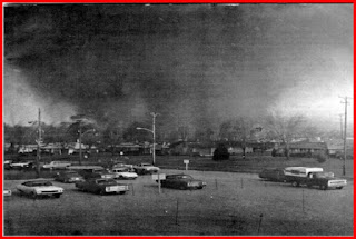
This week I would like to venture into a situation that can be very costly both in property and loss of life.   Let’s examine the tornado.  This is usually a rather small storm, but extremely violent. Tornadoes generally affect an area only, perhaps, a mile wide.  However, it can move along the earth for many miles, affecting all those located in its path.  Tornadoes usually develop from severe thunderstorms. Generally, the scenario goes like this.  Hot and humid air exists in the Gulf States.  Cold air comes racing south from Canada.  Meanwhile, dry air is filtering into the area from the west, coming down slope from the Rocky Mountains.  The mixture of hot moist air with cold dry air plus in infusion of air from the west makes the atmosphere extremely unstable.  First, the severe thunderstorm, then the spinning funnel appears.  Some funnels never touch the ground, others do. Much study is being devoted to the dreaded tornado.  Great advances have been made, but still much is unknown.


Now during the month of February tornadoes begin affecting the states bordering the Gulf of Mexico.  As March and April approach, tornadoes begin to develop in the Texas, Oklahoma, Nebraska area and surrounding states.  Come the months of May and June, it is common to see tornadoes ripping across the landscapes of Iowa, Missouri, and Minnesota, even the Dakotas.  It is safe to say, however, very few places in the United States never experience a tornado. 


During the spring and summer, it is not out of the question that a tornado touches down in the northeast.  Unlike the tornadoes in the Gulf States and the mid west (tornado alley), tornadoes in the northeast are usually of very short duration.  Some funnels just skim the ground, other remain on the ground only for a few minutes.  Tornadoes out west, where the ground is flat, can stay alive for an hour or more, causing devastation everywhere in its path.  Some tornadoes travel for hundreds of miles, knocking down huge trees, telephone poles, wires, throwing cars and trucks around like they were toys, even flattening buildings. Many people living in areas that are prone to tornadoes construct storm cellars in order to survive.


Stories about tornadoes are quite common. Unfortunately, many of them are true.  We hear about a baby being ripped from a mother’s arms and found a few blocks away with only a few scratches and bruises.  We hear of cars and huge trucks being carried high in the sky and being whirled around in the funnel, finally coming back down to earth as the tornado weakens.  One man went into his storm cellar and his dog was following.  As the tornado went overhead, the dog was sucked out of the cellar into the tornado.  The dog was never seen again.

So what should you do if a tornado is heading for your area and you do not have a storm cellar?  Cars are not safe.  Holding on to a tree is no solution.  The best thing one can do is finding a structure.  If you are close to home, get into your house.  If you have a cellar, go down into the cellar and stay away from windows.  If your house has no cellar, and many do not, get to the center of the house …again, away from windows. If you can, get on the floor, perhaps under a bed.  Some have suggested get into the bathtub and if possible cover yourself with something to protect yourself from falling objects. Do not, I repeat, do not go outside to take pictures of the tornado.  Many a life has been lost doing that.


Next week I will discuss another killer storm, the dreaded hurricane. When does it occur? Where does it occur? And how does it usually kill.

Thursday, May 7, 2015

Spring Rain


Spring is here and for the eastern half of the country it has been some winter.  Very cold into the deep south and plenty of snow up north.  The sun is now advancing slowly northward and hot weather will be upon us. Hello to another weather phenomenon, the thunderstorm.  We are all familiar with thunderstorms, heavy rain, gusty winds, lightning, thunder and even sometimes hail.  Let’s take a closer look at a thunderstorm and see what causes it. 

Basically you need heat, cold and moisture.  Specifically, very warm or hot air at the surface, plenty of moisture available and a very important ingredient cold air in the upper atmosphere.  When it is hot at the surface and cold aloft, we say the atmosphere is unstable.  So, here We go…on a hot summer afternoon, surface temperature readings in the 90’s, the surface air is very moist, the air begins to rise.  As long as this Parcel of air is warmer than the air surrounding it, the air will continue to rise.  As this air rises higher in the sky, the upper air surrounding the parcel continues to be colder and colder.  This causes the air to continue to rise.


 The air will rise until the air surrounding this parcel is the same temperature as the parcel.  If, however, the upper atmosphere is cold all the way up to 60,000-70,000 ft. The parcel will rise that high.  Also, remember the surface air contained a great deal of moisture.  Well, air is like a sponge, warm air can hold a large amount of moisture, however, as the air gets colder, it is like squeezing the Sponge.  Water is released,  if you squeeze the sponge quickly, a great deal of water is released at once….a Heavy downpour.  So, in general, rising air causes clouds and precipitation because rising air expands and cools  and can not hold as much moisture as warm air can. That explains the rainfall during a thunderstorm…what about the lightning and thunder?  Let’s forget mathematics etc and explain these features in a very down to earth fashion.   In a thunderhead cloud, also called a cumulonimbus cloud, there is plenty of water vapor.  Water, as you know, is h20

Two hydrogen atoms and one oxygen atom.  Hydrogen has an electrical charge of plus one.  Since there are two hydrogen atoms, it has a plus two Charge.  However, oxygen has a negative charge, a minus 2 charge.  So, when you combine two hydrogen (+2) with one oxygen (-2), you get water.

With a zero charge.  In a thunderhead cloud there are tremendous up and down drafts of air.  Planes flying through a thunderhead would be damaged severely if not destroyed completely.  Anyway, these up and down drafts of air rip the water molecules apart.  The h’s are ripped from the (oh’s).  These particles are now charged.  The (oh) has a negative charge while the “h” has a positive charge.  The positive charges accumulate at the top of the cloud while the negative charges are found at the base of the cloud.  Beneath the cloud, positive charges prevail.  Since opposites attract, the positive and negatives try to interact.  As the storm system moves along, the positive charges on the ground follow along.  Finally, when A high object appears in the storm’s    path, the positive charges climb up the high object, be it a tree, a hill, a tall building.   The negative charge and the positive charge are now closer together and there is less resistance between them. 
 
A huge spark occurs when the charges comes together.  We call this lightning.  Lightning can go from cloud to ground, we call this cloud to ground lightning.  Sometimes lightning goes from one cloud to another cloud and does not strike the ground.  We call this cloud to cloud lightning.  Next week i will talk more about lightning , a few safety measures and then discuss thunder and hail.